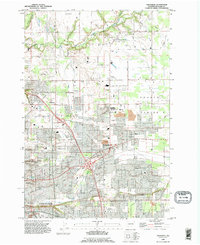
1990 Map of Orchards
USGS Topo · Published 1995About this map
The expanding suburban landscape of Clark County in the early 1990s is anchored by the sprawling Vancouver city limits and the agricultural traditions of Fourth Plains. This map reveals a transition from rural homesteads to residential development, where older communities like Brush Prairie and Barberton remain distinct nodes amidst a growing grid of streets such as Ne 119th ST and Ne 78th ST. The terrain is carved by the winding paths of Salmon Creek and Curtin Creek, which provide natural boundaries for neighborhood clusters.
Find a feature on this map
69 named features on this map. Tap any name to fly to it.
Don’t see what you’re looking for? This feature index may not catch every label — zoom into the map to look around manually.
Map Details
Editions of this 1990 Orchards Map
This is the sole edition of this map. No revisions or reprints were ever made.
Other maps of this area

1897 · Portland
USGS Topo · 1:62,500

1905 · Portland
USGS Topo · 1:62,500

1918 · Troutdale
USGS Topo · 1:62,500

1934 · Troutdale
USGS Topo · 1:48,000

1940 · Portland
USGS Topo · 1:62,500

1940 · La Center
USGS Topo · 1:62,500

1941 · Yacolt
USGS Topo · 1:62,500

1941 · Camas
USGS Topo · 1:62,500

1942 · Camas
USGS Topo · 1:62,500

1948 · Vancouver
USGS Topo · 1:250,000