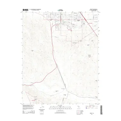
2015 Map of Orcutt
USGS Topo · Published 2015About this map
Orcutt serves as the primary residential hub on this Santa Barbara County landscape, flanked by the developing residential pockets of Cimarron Estates and the more isolated locale of Bicknell. The terrain is defined by a series of prominent uplands, including the Solomon Hills, Casmalia Hills, and the Purisima Hills, which together frame the fertile lowlands of the San Antonio Valley and Los Alamos Valley. These valleys are drained by seasonal watercourses such as San Antonio Cr and Orcutt Cr, indicating a geography heavily influenced by the drainage patterns between these coastal ridges.
Find a feature on this map
100 named features on this map. Tap any name to fly to it.
Don’t see what you’re looking for? This feature index may not catch every label — zoom into the map to look around manually.
Map Details
Editions of this 2015 Orcutt Map
This is the sole edition of this map. No revisions or reprints were ever made.
Other maps of this area

1905 · Guadalupe
USGS Topo · 1:125,000

1905 · Lompoc
USGS Topo · 1:125,000

1942 · Point Arguello
USGS Topo · 1:62,500

1942 · Guadalupe
USGS Topo · 1:125,000

1942 · Lompoc
USGS Topo · 1:125,000

1942 · Lompoc
USGS Topo · 1:62,500

1942 · Santa Maria
USGS Topo · 1:62,500

1942 · Point Sal
USGS Topo · 1:62,500

1943 · Lompoc
USGS Topo · 1:125,000

1947 · Lompoc
USGS Topo · 1:24,000