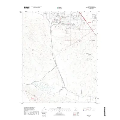
2018 Map of Orcutt
USGS Topo · Published 2018About this map
Orcutt serves as the primary hub of this landscape, where residential street grids like Cherry Ave and Patterson Rd meet the educational and spiritual grounds of College and Saint Joseph Seminary. The terrain to the south and east transitions into a complex system of ridges and canyons, most notably the Solomon Hills and Graciosa Ridge. These heights are punctuated by distinctive landmarks such as Newlove Hill and Mt Solomon, while the lowlands are defined by the paths of Orcutt Cr and the wider San Antonio Valley. The southern portion of the map reveals the reaches of the Purisima Hills and the drainage of San Antonio Cr, where the riparian environment of Barker Slough provides a sharp contrast to the surrounding upland topography. This area illustrates the late 2010s balance between the expanding community of Orcutt and the enduring agricultural and natural relief of the Santa Barbara County interior.
Find a feature on this map
98 named features on this map. Tap any name to fly to it.
Don’t see what you’re looking for? This feature index may not catch every label — zoom into the map to look around manually.
Map Details
Editions of this 2018 Orcutt Map
This is the sole edition of this map. No revisions or reprints were ever made.
Other maps of this area

1905 · Guadalupe
USGS Topo · 1:125,000

1905 · Lompoc
USGS Topo · 1:125,000

1942 · Point Arguello
USGS Topo · 1:62,500

1942 · Guadalupe
USGS Topo · 1:125,000

1942 · Lompoc
USGS Topo · 1:125,000

1942 · Lompoc
USGS Topo · 1:62,500

1942 · Santa Maria
USGS Topo · 1:62,500

1942 · Point Sal
USGS Topo · 1:62,500

1943 · Lompoc
USGS Topo · 1:125,000

1947 · Lompoc
USGS Topo · 1:24,000