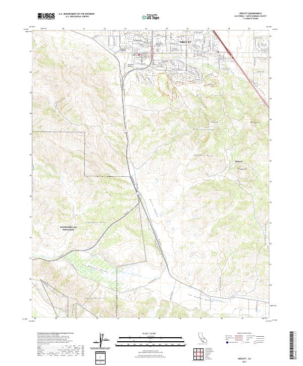
2021 Map of Orcutt
USGS Topo · Published 2021About this map
Orcutt serves as the primary northern anchor for this survey, showcasing a dense residential grid punctuated by local educational landmarks like the Saint Joseph Seminary College. The landscape transitions rapidly from these developed streets into the complex topography of the Solomon Hills and Casmalia Hills, where narrow canyons like Graciosa Canyon and Solomon Canyon define the drainage patterns of the region. This 2021 update reveals the persistent agricultural and open-space character of the San Antonio Valley to the south, where the intermittent waters of Barkas Slough and San Antonio Cr collect. The contrast between the suburban expansion near Old Mill Ln and the open terrain of Graciosa Ridge and Mt Solomon illustrates the unique positioning of the Santa Maria Valley edge, where residential life meets the steep, folded ridges and valleys typical of coastal Santa Barbara County.
Find a feature on this map
110 named features on this map. Tap any name to fly to it.
Don’t see what you’re looking for? This feature index may not catch every label — zoom into the map to look around manually.
Map Details
Editions of this 2021 Orcutt Map
This is the sole edition of this map. No revisions or reprints were ever made.
Other maps of this area

1905 · Guadalupe
USGS Topo · 1:125,000

1905 · Lompoc
USGS Topo · 1:125,000

1942 · Point Arguello
USGS Topo · 1:62,500

1942 · Guadalupe
USGS Topo · 1:125,000

1942 · Lompoc
USGS Topo · 1:125,000

1942 · Lompoc
USGS Topo · 1:62,500

1942 · Santa Maria
USGS Topo · 1:62,500

1942 · Point Sal
USGS Topo · 1:62,500

1943 · Lompoc
USGS Topo · 1:125,000

1947 · Lompoc
USGS Topo · 1:24,000