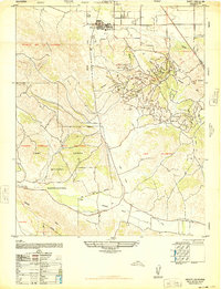
1947 Map of Orcutt
USGS Topo · Published 1948About this map
Oil fields and rugged petroleum infrastructure dominate the landscape of the Solomon Hills in this 1947 survey. The town of Orcutt serves as a primary hub for the local industry, featuring the Orcutt Union School and a complex network of oil pits and pipelines. To the south and west, the map documents the extensive footprint of the Camp Cooke Military Reservation, which spans across portions of Todos Santos y San Antonio and Los Alamos. The terrain is defined by deep cuts like Graciosa Canyon and Harris Canyon, with industrial outposts such as Bicknell and the Divide Sub Station situated among the winding ridges. Tracing San Antonio Creek through the San Antonio valley reveals a sparsely settled ranching and industrial corridor between the Casmalia Hills and the Purisima Hills.
Find a feature on this map
22 named features on this map. Tap any name to fly to it.
Don’t see what you’re looking for? This feature index may not catch every label — zoom into the map to look around manually.
Map Details
Editions of this 1947 Orcutt Map
This is the sole edition of this map. No revisions or reprints were ever made.
Other maps of this area

1905 · Guadalupe
USGS Topo · 1:125,000

1905 · Lompoc
USGS Topo · 1:125,000

1942 · Point Arguello
USGS Topo · 1:62,500

1942 · Guadalupe
USGS Topo · 1:125,000

1942 · Lompoc
USGS Topo · 1:125,000

1942 · Lompoc
USGS Topo · 1:62,500

1942 · Santa Maria
USGS Topo · 1:62,500

1942 · Point Sal
USGS Topo · 1:62,500

1943 · Lompoc
USGS Topo · 1:125,000

1947 · Lompoc
USGS Topo · 1:24,000