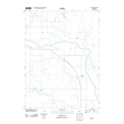
2011 Map of Ord SE
USGS Topo · Published 2011About this map
The North Loup River valley in Valley County defines this rural landscape, characterized by an extensive network of irrigation infrastructure essential to Nebraska agriculture. This 2011 survey details the complex water management system of the region, including the Ord North Loup Canal and the Burwell Sumter Canal that parallel the river's course. Smaller settlements like Spelts and Sumter are situated among the grid of section roads, such as Springdale Rd, which connect the upland pastures to the fertile bottomlands.
Find a feature on this map
16 named features on this map. Tap any name to fly to it.
Don’t see what you’re looking for? This feature index may not catch every label — zoom into the map to look around manually.
Map Details
Editions of this 2011 Ord SE Map
This is the sole edition of this map. No revisions or reprints were ever made.
Other maps of this area

1899 · Loup
USGS Topo · 1:125,000

1953 · Loup City NW
USGS Topo · 1:24,000

1953 · North Loup
USGS Topo · 1:24,000

1953 · Scotia
USGS Topo · 1:24,000

1954 · Ord SE
USGS Topo · 1:24,000

1954 · Ord
USGS Topo · 1:24,000

1954 · Ord NE
USGS Topo · 1:24,000

1954 · Horace
USGS Topo · 1:24,000

1954 · Ord NW
USGS Topo · 1:24,000

1954 · Greeley NW
USGS Topo · 1:24,000