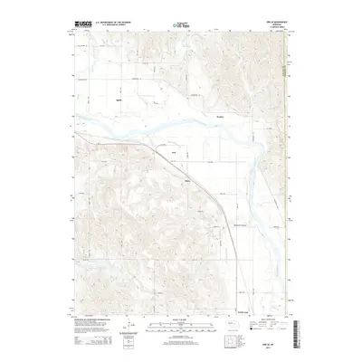
2014 Map of Ord SE
USGS Topo · Published 2014About this map
The North Loup River valley dominates this 2014 survey of Valley and Greeley counties, illustrating a landscape defined by its irrigation infrastructure. The Ord-North Loup Canal and the Burwell-Sumter Canal trace the contours of the valley floor, supporting the agricultural lifeblood of small Nebraska communities. Near the southern edge of the map, the village of North Loup sits along the riverbanks, while the settlement of Ord is positioned further north. These areas are connected by the path of Ne-11, which runs parallel to the river and the defunct rail corridors that once served these towns.
Find a feature on this map
38 named features on this map. Tap any name to fly to it.
Don’t see what you’re looking for? This feature index may not catch every label — zoom into the map to look around manually.
Map Details
Editions of this 2014 Ord SE Map
This is the sole edition of this map. No revisions or reprints were ever made.
Other maps of this area

1899 · Loup
USGS Topo · 1:125,000

1953 · Loup City NW
USGS Topo · 1:24,000

1953 · North Loup
USGS Topo · 1:24,000

1953 · Scotia
USGS Topo · 1:24,000

1954 · Ord SE
USGS Topo · 1:24,000

1954 · Ord
USGS Topo · 1:24,000

1954 · Ord NE
USGS Topo · 1:24,000

1954 · Horace
USGS Topo · 1:24,000

1954 · Ord NW
USGS Topo · 1:24,000

1954 · Greeley NW
USGS Topo · 1:24,000