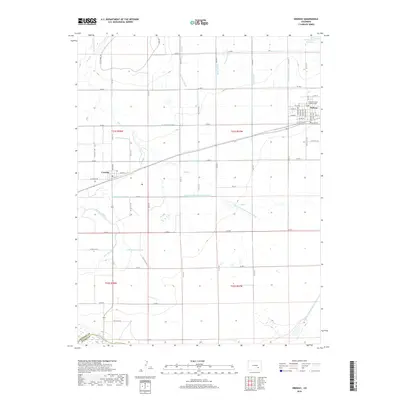
2019 Map of Ordway
USGS Topo · Published 2019About this map
Ordway and Crowley anchor this high plains landscape, where an intricate web of irrigation infrastructure defines the local geography. The massive Colorado Canal and Crowley Drain Canal represent a sophisticated water management system vital to this region of Crowley County. Numerous laterals, such as the Boston-Lateral and Drescher Lateral, crisscross the terrain to support agriculture between the northern Antelope Mesa and the Arkansas River to the south. The map details the concentrated grid of Ordway, the county seat, including the Crowley County Justice Center and the nearby Ordway Town Reservoir. This 2019 survey documents a landscape where the natural flow of Bob Cr has been supplemented by a dense network of engineered waterways, tracing the historical and modern reliance on water rights and canal systems in this part of Colorado.
Find a feature on this map
77 named features on this map. Tap any name to fly to it.
Don’t see what you’re looking for? This feature index may not catch every label — zoom into the map to look around manually.
Map Details
Editions of this 2019 Ordway Map
This is the sole edition of this map. No revisions or reprints were ever made.
Other maps of this area

1891 · Catlin
USGS Topo · 1:125,000

1893 · Catlin
USGS Topo · 1:125,000

1954 · Olney Springs
USGS Topo · 1:24,000

1954 · Elder
USGS Topo · 1:24,000

1954 · Sugar City
USGS Topo · 1:24,000

1954 · Ordway
USGS Topo · 1:24,000

1954 · Manzanola
USGS Topo · 1:24,000

1954 · Lamar
USGS Topo · 1:250,000

1955 · Rocky Ford
USGS Topo · 1:24,000

1958 · Lamar
USGS Topo · 1:250,000