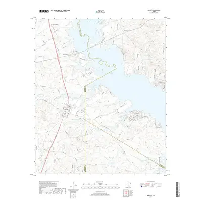
2019 Map of Ore City
USGS Topo · Published 2019About this map
Ore City and the surrounding piney woods of East Texas are defined by the expansive waters of Lake O' the Pines, which dominates the northern and eastern landscape of this quadrangle. The terrain is a network of creek drainages including Meddlin Cr, Sandy Cr, and Jones Cr, punctuated by smaller water bodies such as Satterwhite Ranch Lake and Ferguson Lake. The map reveals a transition from the established grid of the city to more rural developments like Cedar Springs. Genealogists and local historians can pinpoint the Cedar Grove Cem located south of the main lake body. The landscape is also marked by significant county boundaries where Upshur, Marion, and Harrison Counties meet, reflecting the complex political geography of the region near Railroad Pond.
Find a feature on this map
117 named features on this map. Tap any name to fly to it.
Don’t see what you’re looking for? This feature index may not catch every label — zoom into the map to look around manually.
Map Details
Editions of this 2019 Ore City Map
This is the sole edition of this map. No revisions or reprints were ever made.
Other maps of this area

1956 · Tyler
USGS Topo · 1:250,000

1960 · Coffeeville
USGS Topo · 1:24,000

1960 · Glenwood
USGS Topo · 1:24,000

1960 · La Fayette
USGS Topo · 1:24,000

1961 · Lassater
USGS Topo · 1:24,000

1961 · Harleton
USGS Topo · 1:24,000

1962 · Ashland
USGS Topo · 1:24,000

1962 · Avinger
USGS Topo · 1:24,000

1962 · Ore City
USGS Topo · 1:24,000

1962 · Lone Star
USGS Topo · 1:24,000