
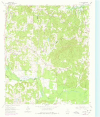
1962 Map of Ashland
USGS Topo · Published 1964About this map
Ashland and the surrounding woodlands of Harrison County are captured in this 1962 survey during a period of transition for the East Texas landscape. The southern reaches of Lake O' The Pines dominate the northern border, where the flooding of the reservoir altered the local drainage patterns of Walnut Creek. Further south, the map documents a network of rural communities such as Old Diana, James, and Macedonia, each anchored by central landmarks like the Walnut Creek Ch and Simmons Ch.
Find a feature on this map
40 named features on this map. Tap any name to fly to it.
Don’t see what you’re looking for? This feature index may not catch every label — zoom into the map to look around manually.
Map Details
Editions of this 1962 Ashland Map
2 editions found
Other maps of this area

1956 · Tyler
USGS Topo · 1:250,000

1960 · White Oak
USGS Topo · 1:24,000

1960 · Coffeeville
USGS Topo · 1:24,000

1960 · Glenwood
USGS Topo · 1:24,000

1961 · Hallsville
USGS Topo · 1:24,000

1961 · Lassater
USGS Topo · 1:24,000

1961 · Harleton
USGS Topo · 1:24,000

1962 · Longview Heights
USGS Topo · 1:24,000

1962 · Ore City
USGS Topo · 1:24,000

1984 · Tyler
USGS Topo · 1:250,000