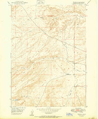
1950 Map of Oreana
USGS Topo · Published 1950About this map
Oreana serves as the focal point of this high-desert Owyhee County landscape, situated along the Boise Meridian where the terrain descends toward the Snake River valley. The community infrastructure is clearly documented, including the Oreana School, a Po, and a nearby Cem. The map reveals a land defined by its drainage systems, with multiple seasonal waterways such as Picket Creek, Catherine Creek, and Bates Creek cutting through the topography.
Find a feature on this map
17 named features on this map. Tap any name to fly to it.
Don’t see what you’re looking for? This feature index may not catch every label — zoom into the map to look around manually.
Map Details
Editions of this 1950 Oreana Map
This is the sole edition of this map. No revisions or reprints were ever made.
Other maps of this area

1892 · Bisuka
USGS Topo · 1:125,000

1892 · Silver City
USGS Topo · 1:125,000

1894 · Bisuka
USGS Topo · 1:125,000

1894 · Silver City
USGS Topo · 1:125,000

1898 · Silver City
USGS Topo · 1:125,000

1947 · Wild Horse Butte
USGS Topo · 1:24,000

1948 · Castle Butte
USGS Topo · 1:24,000

1948 · Wild Horse Butte
USGS Topo · 1:24,000

1948 · Sinker Butte
USGS Topo · 1:24,000

1949 · Sinker Butte
USGS Topo · 1:24,000