
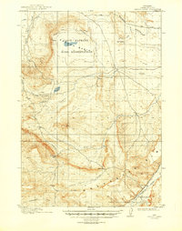
1913 Map of Oregon Basin
USGS Topo · Published 1913About this map
The Oregon Basin Bird Reservation anchors this 1910-1911 survey of Park County, centering on the prominent waters of Loch-Katrine. The landscape reveals a complex history of early irrigation and resource extraction, notably the presence of the Wiley Canal (Abandoned) and various segments of the Wiley Canal. Industrial activity is marked by the Eagle Mine and Wiley Mine, while local transit follows the established Cody and Meeteetse Road and the Cody and Burlington Road. In the southern reaches, the Greybull River flows past Sleeper's Ranch, providing a rare point of named habitation in a territory defined by distinctive landforms like Elk Butte and the sharp relief of the Meeteetse rim. The presence of multiple abandoned road and canal segments suggests a period of rapid adjustment to the harsh Wyoming environment as early settlers and engineers sought to harness the basin's water and mineral wealth.
Find a feature on this map
22 named features on this map. Tap any name to fly to it.
Don’t see what you’re looking for? This feature index may not catch every label — zoom into the map to look around manually.
Map Details
Editions of this 1913 Oregon Basin Map
2 editions found
Other maps of this area

1911 · Meeteetse
USGS Topo · 1:62,500

1911 · Oregon Basin
USGS Topo · 1:62,500

1913 · Meeteetse
USGS Topo · 1:62,500

1949 · Cody
USGS Topo · 1:62,500

1951 · Cody
USGS Topo · 1:62,500

1951 · Y U Bench NW
USGS Topo · 1:24,000

1951 · Sheets Flat
USGS Topo · 1:24,000

1951 · Wilson Spring
USGS Topo · 1:24,000

1955 · Cody
USGS Topo · 1:250,000

1957 · Devils Tooth
USGS Topo · 1:62,500