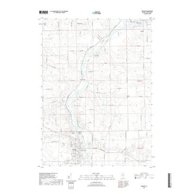
2018 Map of Oregon
USGS Topo · Published 2018About this map
The Rock River winds prominently through Ogle County, connecting the northern settlement of Byron with the city of Oregon to the south. This corridor is defined by a dense network of country roads such as N State Rte 2 and N German Church Rd, which link established agricultural lands to riverfront landmarks like Margaret Fuller Island. The mapping of cemetery sites, including Riverside Cem, Riverview Cem, and Saint Mary's Cem, provides a detailed record of the region's long-term settlement and community nodes. Numerous tributaries, including Leaf River, Mud Cr, and Black Walnut Cr, cut through the terrain to feed the primary river system. Near Oregon, the proximity of Duane E Davis Airport to the river's edge illustrates the modern transport infrastructure integrated into this traditional river valley landscape.
Find a feature on this map
100 named features on this map. Tap any name to fly to it.
Don’t see what you’re looking for? This feature index may not catch every label — zoom into the map to look around manually.
Map Details
Editions of this 2018 Oregon Map
This is the sole edition of this map. No revisions or reprints were ever made.
Other maps of this area

1917 · Kings
USGS Topo · 1:62,500

1918 · Dixon
USGS Topo · 1:62,500

1918 · Kings
USGS Topo · 1:62,500

1922 · Oregon
USGS Topo · 1:62,500

1924 · Oregon
USGS Topo · 1:62,500

1950 · Dixon
USGS Topo · 1:62,500

1952 · Rochelle
USGS Topo · 1:62,500

1954 · Rockford
USGS Topo · 1:250,000

1955 · Rockford
USGS Topo · 1:250,000

1958 · Aurora
USGS Topo · 1:250,000