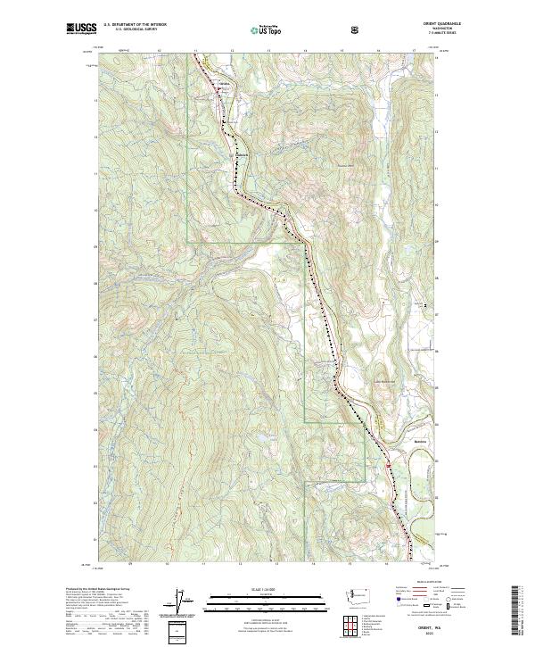
2023 Map of Orient
USGS Topo · Published 2023About this map
The Kettle River valley serves as the primary corridor for settlement and transit through this portion of Ferry and Stevens counties. The small communities of Orient, Dulwich, and Barstow follow the river's winding course, connected by a network of rural roads such as Orient Cutoff Rd and Kettle River Rd. Much of the western landscape is dominated by the steep terrain of the Colville National Forest, where features like Thompson Ridge and South Fork Boulder Creek define the wilderness character of the region. Local history is anchored by sites such as the Orient Cem and Kelly Hill Cem, while topographic landmarks like Toulou Mtn and Little Marble Mtn tower over the narrow river flats and the waters of Renner Lake.
Find a feature on this map
46 named features on this map. Tap any name to fly to it.
Don’t see what you’re looking for? This feature index may not catch every label — zoom into the map to look around manually.
Map Details
Editions of this 2023 Orient Map
This is the sole edition of this map. No revisions or reprints were ever made.
Other maps of this area

1936 · Marcus
USGS Topo · 1:96,000

1942 · Marcus
USGS Topo · 1:125,000

1948 · Sherman Peak
USGS Topo · 1:62,500

1948 · Kettle Falls
USGS Topo · 1:62,500

1948 · Orient
USGS Topo · 1:62,500

1948 · Togo Mountain
USGS Topo · 1:62,500

1951 · Togo Mountain
USGS Topo · 1:62,500

1951 · Sherman Peak
USGS Topo · 1:62,500

1951 · Orient
USGS Topo · 1:62,500

1951 · Kettle Falls
USGS Topo · 1:62,500