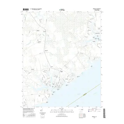
2016 Map of Oriental
USGS Topo · Published 2016About this map
The coastal village of Oriental sits at the confluence of Greens Creek and the Neuse River, serving as a primary hub for maritime activity in this part of Pamlico County. The landscape is defined by its intricate network of tidal creeks and brackish bays, including Upper McCotter Bay and Broad Creek. To the north, the small settlements of Merritt and Gibbton are connected by inland routes like Florence Rd, while the eastern shoreline near Whortonsville and Pamlico features a series of distinct landforms such as Graveyard Point and Bulah Point.
Find a feature on this map
128 named features on this map. Tap any name to fly to it.
Don’t see what you’re looking for? This feature index may not catch every label — zoom into the map to look around manually.
Map Details
Editions of this 2016 Oriental Map
This is the sole edition of this map. No revisions or reprints were ever made.
Other maps of this area

1948 · Oriental
USGS Topo · 1:24,000

1949 · Merrimon
USGS Topo · 1:24,000

1949 · South River
USGS Topo · 1:24,000

1949 · Cherry Point
USGS Topo · 1:24,000

1950 · South River
USGS Topo · 1:24,000

1950 · Vandemere
USGS Topo · 1:24,000

1950 · Jones Bay
USGS Topo · 1:24,000

1950 · Arapahoe
USGS Topo · 1:24,000

1951 · Arapahoe
USGS Topo · 1:24,000
1951 · Merrimon
USGS Topo · 1:24,000