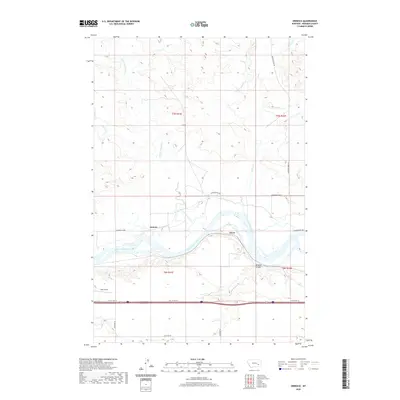
2020 Map of Orinoco
USGS Topo · Published 2020About this map
The Yellowstone River anchors this central Montana landscape, cutting a wide path through Rosebud County. Small settlements and specialized landmarks like Orinoco and Flynn sit along the northern bank, while the landing strip at Tillitt Field serves the local ranching and agricultural community south of the water. The map documents a classic Western transport corridor, showing the alignment of Old US Hwy 10 running parallel to the river. Tributaries such as Little Porcupine Cr and Horse Cr drain the surrounding heights, leading down toward the breaks of Wildcat Coulee. Notable local thoroughfares, including Cartersville Rd and Quarter Horse Rd, provide a window into the rural road network and land divisions that have long defined this river-bottom economy.
Find a feature on this map
17 named features on this map. Tap any name to fly to it.
Don’t see what you’re looking for? This feature index may not catch every label — zoom into the map to look around manually.
Map Details
Editions of this 2020 Orinoco Map
This is the sole edition of this map. No revisions or reprints were ever made.
Other maps of this area

1954 · Forsyth
USGS Topo · 1:250,000

1957 · Forsyth
USGS Topo · 1:250,000

1958 · Forsyth
USGS Topo · 1:250,000

1968 · Orinoco
USGS Topo · 1:24,000

1968 · Rosebud
USGS Topo · 1:24,000

1968 · Box Canyon Coulee
USGS Topo · 1:24,000

1968 · Forsyth
USGS Topo · 1:24,000

1968 · Schultz Coulee
USGS Topo · 1:24,000

1968 · Black Coulee
USGS Topo · 1:24,000

1971 · Smith Creek NE
USGS Topo · 1:24,000