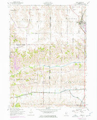
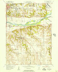
1953 Map of Orion
USGS Topo · Published 1976About this map
The Fourth Principal Meridian serves as a primary boundary in this corner of Illinois, dividing the agricultural landscape where Rock Island, Mercer, and Henry Counties meet. The village of Orion sits at a rail junction in the northeast, while the smaller settlements of Sherrard, Swedona, and Ophiem anchor the surrounding rural townships. This 1953 survey, updated with 1970s revisions, illustrates a region defined by its waterway network, including Camp Creek and the Edwards River valley, which cut through the undulating prairie. Local history is deeply etched into the land through numerous rural institutions, from the Rural Town Hall School and Caughey School to several pioneer-era burial grounds like Western Cemetery and Greenbush Cemetery. The presence of the Chicago Rock Island and Pacific railroad tracks and the Sherrard Orion Road highlights the transportation corridors that sustained these farming communities through the mid-20th century.
Find a feature on this map
34 named features on this map. Tap any name to fly to it.
Don’t see what you’re looking for? This feature index may not catch every label — zoom into the map to look around manually.
Map Details
Editions of this 1953 Orion Map
3 editions found
Other maps of this area

1912 · Milan
USGS Topo · 1:62,500

1923 · Alexis
USGS Topo · 1:62,500

1925 · Alexis
USGS Topo · 1:62,500

1937 · Orion
USGS Topo · 1:62,500

1944 · Milan
USGS Topo · 1:62,500

1947 · Woodhull
USGS Topo · 1:62,500
1948 · Milan
USGS Topo · 1:24,000

1949 · Coal Valley
USGS Topo · 1:24,000

1950 · Milan
USGS Topo · 1:24,000
1953 · Coal Valley
USGS Topo · 1:24,000