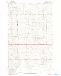
1967 Map of Oriska
USGS Topo · Published 1990About this map
The town of Oriska serves as the focal point of this Barnes County landscape, situated where the Northern Pacific railroad cuts through the prairie. The 1967 field check records the area during the development of the Missouri River Basin, capturing the community's layout and its spiritual landmarks including Oriska Cem and St Bernards Cem. The terrain is characterized by a high density of small water bodies and wetlands typical of the region's glacial topography.
Find a feature on this map
16 named features on this map. Tap any name to fly to it.
Don’t see what you’re looking for? This feature index may not catch every label — zoom into the map to look around manually.
Map Details
Editions of this 1967 Oriska Map
2 editions found
Other maps of this area

1897 · Tower
USGS Topo · 1:125,000

1952 · Grand Forks
USGS Topo · 1:250,000

1953 · Fargo
USGS Topo · 1:250,000

1956 · Fargo
USGS Topo · 1:250,000

1956 · Grand Forks
USGS Topo · 1:250,000

1961 · Valley City East
USGS Topo · 1:24,000

1965 · Tower City SW
USGS Topo · 1:24,000

1966 · Grand Forks
USGS Topo · 1:250,000

1967 · Tower City
USGS Topo · 1:24,000

1967 · Pillsbury SE
USGS Topo · 1:24,000