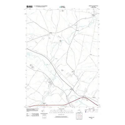
2010 Map of Oriskany
USGS Topo · Published 2010About this map
The Oriskany Battle Monument and Unknown Soldier Monument anchor the western edge of this 2010 landscape, marking the significant Revolutionary War history of the region. The Mohawk River and Oriskany Creek converge near the settlement of Oriskany, illustrating how water routes and industrial sites like Colemans Mills shaped the development of Oneida County.
Find a feature on this map
75 named features on this map. Tap any name to fly to it.
Don’t see what you’re looking for? This feature index may not catch every label — zoom into the map to look around manually.
Map Details
Editions of this 2010 Oriskany Map
This is the sole edition of this map. No revisions or reprints were ever made.
Other maps of this area

1895 · Oriskany
USGS Topo · 1:62,500

1897 · Remsen
USGS Topo · 1:62,500

1898 · Utica
USGS Topo · 1:62,500

1898 · Oriskany
USGS Topo · 1:62,500

1900 · Utica
USGS Topo · 1:62,500

1900 · Remsen
USGS Topo · 1:62,500

1904 · Boonville
USGS Topo · 1:62,500

1943 · Utica East
USGS Topo · 1:24,000
1945 · Utica East
USGS Topo · 1:31,680
1945 · South Trenton
USGS Topo · 1:31,680