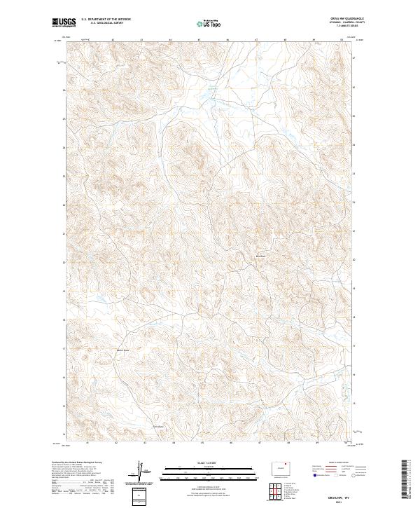
2021 Map of Oriva NW
USGS Topo · Published 2021About this map
The drainage basins of the Powder River Country define this landscape in north-central Campbell County, where numerous intermittent creek prongs and draws carve through the high plains. The water management system is anchored by the Gupton 18 Reservoir in the northern reaches, collecting flow from Jamison Prong Wildcat Cr. The map reveals a complex network of seasonal waterways, including Road Prong, Rawhide Cr, and Nine T Bar Cr, which trace the natural topography of this ranching-oriented terrain.
Find a feature on this map
16 named features on this map. Tap any name to fly to it.
Don’t see what you’re looking for? This feature index may not catch every label — zoom into the map to look around manually.
Map Details
Editions of this 2021 Oriva NW Map
This is the sole edition of this map. No revisions or reprints were ever made.
Other maps of this area

1954 · Gillette
USGS Topo · 1:250,000

1955 · Gillette
USGS Topo · 1:250,000

1958 · Gillette
USGS Topo · 1:250,000

1962 · Gillette
USGS Topo · 1:250,000

1971 · Wildcat
USGS Topo · 1:24,000

1971 · Oriva NW
USGS Topo · 1:24,000

1971 · Oriva
USGS Topo · 1:24,000
1971 · Calf Creek
USGS Topo · 1:24,000
1971 · Gillette West
USGS Topo · 1:24,000
1971 · Rawhide School
USGS Topo · 1:24,000