
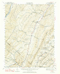
1940 Map of Orkney Springs
USGS Topo · Published 1940About this map
Orkney Springs serves as a prominent mountain resort center within the George Washington National Forest, marking a landscape defined by its mineral springs and historic retreats. This 1940 survey by C. S. Maltby and H. C. Crumpacker captures the region as it transitioned toward modern tourism while maintaining its rural foundations. To the west, the settlement of Bergton sits along the Germany River, supported by local infrastructure like the Bergton Sch.
Find a feature on this map
61 named features on this map. Tap any name to fly to it.
Don’t see what you’re looking for? This feature index may not catch every label — zoom into the map to look around manually.
Map Details
Editions of this 1940 Orkney Springs Map
2 editions found
Other maps of this area

1891 · Romney
USGS Topo · 1:125,000

1892 · Franklin
USGS Topo · 1:125,000

1892 · Woodstock
USGS Topo · 1:125,000

1895 · Piedmont
USGS Topo · 1:125,000

1896 · Franklin
USGS Topo · 1:125,000

1920 · Petersburg
USGS Topo · 1:48,000

1920 · Moorefield
USGS Topo · 1:62,500

1921 · Orkney Springs
USGS Topo · 1:48,000

1921 · Petersburg
USGS Topo · 1:48,000

1921 · Greenland Gap
USGS Topo · 1:62,500