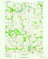
1960 Map of Orland
USGS Topo · Published 1962About this map
Orland and the surrounding townships of Millgrove, Springfield, Jackson, and Greenfield define this landscape along the Lagrange and Steuben County line. The topography is dominated by a complex network of glacial kettle lakes and wetlands, including Wall Lake, Lime Lake, and the elongated Otter Lake. The Pigeon River and Fawn River drain these basins, with the Pigeon River State Game Preserve protecting large swaths of the river corridor.
Find a feature on this map
48 named features on this map. Tap any name to fly to it.
Don’t see what you’re looking for? This feature index may not catch every label — zoom into the map to look around manually.
Map Details
Editions of this 1960 Orland Map
2 editions found
Other maps of this area

1940 · Orland
USGS Topo · 1:24,000

1941 · Orland
USGS Topo · 1:24,000

1941 · Angola West
USGS Topo · 1:24,000

1942 · Ashley
USGS Topo · 1:24,000

1942 · Angola West
USGS Topo · 1:24,000

1942 · Stroh
USGS Topo · 1:24,000

1947 · Mongo
USGS Topo · 1:24,000

1947 · Wolcottville
USGS Topo · 1:24,000

1953 · Fort Wayne
USGS Topo · 1:250,000

1956 · Fort Wayne
USGS Topo · 1:250,000