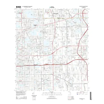
2015 Map of Orlando East
USGS Topo · Published 2015About this map
Lake Maitland and its surrounding chain of lakes anchor this detailed 2015 look at the dense suburban and urban expansion between Orlando, Winter Park, and Casselberry. The landscape is defined by its high concentration of water bodies and educational institutions, featuring the campuses of Rollins Coll on the shores of Lake Virginia, Full Sail Univ in Goldenrod, and the Florida Hospital Coll of Health Sciences. A complex network of roads like Aloma Ave and E Colonial Dr weave together long-standing communities such as Maitland and Bertha.
Find a feature on this map
124 named features on this map. Tap any name to fly to it.
Don’t see what you’re looking for? This feature index may not catch every label — zoom into the map to look around manually.
Map Details
Editions of this 2015 Orlando East Map
This is the sole edition of this map. No revisions or reprints were ever made.
Other maps of this area

1953 · Lake Jessamine
USGS Topo · 1:24,000

1953 · Pine Castle
USGS Topo · 1:24,000

1953 · Oviedo SW
USGS Topo · 1:24,000

1953 · Narcoossee NW
USGS Topo · 1:24,000

1955 · Orlando
USGS Topo · 1:250,000

1956 · Oviedo
USGS Topo · 1:24,000

1956 · Orlando West
USGS Topo · 1:24,000

1956 · Orlando East
USGS Topo · 1:24,000

1957 · Orlando
USGS Topo · 1:250,000

1958 · Orlando
USGS Topo · 1:250,000