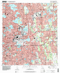
1994 Map of Orlando East
USGS Topo · Published 2000About this map
Orlando and its neighboring communities of Winter Park and Maitland are defined by a dense mosaic of lakes and urban infrastructure in the mid-1990s. The central landscape is anchored by the massive Orlando Naval Training Center and the Orlando Executive Airport, illustrating the city's significant military and aviation footprint. The map documents a mature urban core where established institutions like Rollins College and Greenwood Cemetery sit alongside modern developments such as the East-West Expressway (408) and the Cady Way Bike Path. Cultural landmarks like the Harry P Leu Gardens and Loch Haven Park appear as green oases amid the gridded streets and numerous water bodies, including Lake Baldwin and Lake Eola. This period of the city's growth shows the transition from a railroad-centric town, represented by the Seaboard Coast Line, to a sprawling metropolitan center.
Find a feature on this map
169 named features on this map. Tap any name to fly to it.
Don’t see what you’re looking for? This feature index may not catch every label — zoom into the map to look around manually.
Map Details
Editions of this 1994 Orlando East Map
This is the sole edition of this map. No revisions or reprints were ever made.
Other maps of this area

1953 · Lake Jessamine
USGS Topo · 1:24,000

1953 · Pine Castle
USGS Topo · 1:24,000

1953 · Oviedo SW
USGS Topo · 1:24,000

1953 · Narcoossee NW
USGS Topo · 1:24,000

1955 · Orlando
USGS Topo · 1:250,000

1956 · Oviedo
USGS Topo · 1:24,000

1956 · Orlando West
USGS Topo · 1:24,000

1956 · Orlando East
USGS Topo · 1:24,000

1957 · Orlando
USGS Topo · 1:250,000

1958 · Orlando
USGS Topo · 1:250,000