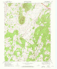
1970 Map of Orlean
USGS Topo · Published 1971About this map
Big Cobbler Mtn and Little Cobbler Mtn dominate the northern landscape of this Fauquier County region, where a traditional Piedmont settlement pattern persists into the 1970s. The village of Orlean serves as a southern anchor, while smaller crossroads like Hume, Ashville, and Morgantown punctuate the surrounding farmland. The presence of several community centers, including Orlean Ch, Leeds Ch, and Thumb Run Ch, highlights the local importance of these historic congregations.
Find a feature on this map
33 named features on this map. Tap any name to fly to it.
Don’t see what you’re looking for? This feature index may not catch every label — zoom into the map to look around manually.
Map Details
Editions of this 1970 Orlean Map
4 editions found
Other maps of this area

1893 · Luray
USGS Topo · 1:125,000

1894 · Warrenton
USGS Topo · 1:125,000

1894 · Warrenton
USGS Topo · 1:62,500

1905 · Luray
USGS Topo · 1:125,000

1927 · Remington
USGS Topo · 1:48,000

1930 · Warrenton
USGS Topo · 1:62,500

1939 · Front Royal
USGS Topo · 1:48,000

1943 · Orlean
USGS Topo · 1:24,000

1943 · Marshall
USGS Topo · 1:24,000

1943 · Upperville
USGS Topo · 1:24,000