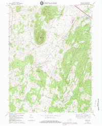
1970 Map of Orlean
USGS Topo · Published 1983About this map
Big Cobbler Mtn and Little Cobbler Mtn dominate the central topography of this Fauquier County landscape, surrounded by a network of rural crossroads and farming communities. In the early 1970s, the settlement of Orlean served as a local hub, anchored by Orlean Ch and several nearby cemeteries. The map reveals a deeply established social geography, where family and community landmarks like Clarks Corner, Wilsons Store, and Jerrys Shop define the local navigation.
Find a feature on this map
34 named features on this map. Tap any name to fly to it.
Don’t see what you’re looking for? This feature index may not catch every label — zoom into the map to look around manually.
Map Details
Editions of this 1970 Orlean Map
4 editions found
Other maps of this area

1893 · Luray
USGS Topo · 1:125,000

1894 · Warrenton
USGS Topo · 1:125,000

1894 · Warrenton
USGS Topo · 1:62,500

1905 · Luray
USGS Topo · 1:125,000

1927 · Remington
USGS Topo · 1:48,000

1930 · Warrenton
USGS Topo · 1:62,500

1939 · Front Royal
USGS Topo · 1:48,000

1943 · Orlean
USGS Topo · 1:24,000

1943 · Marshall
USGS Topo · 1:24,000

1943 · Upperville
USGS Topo · 1:24,000