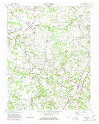
1953 Map of Orlinda
USGS Topo · Published 1980About this map
The South Fork Red River and Honey Run carve a rolling landscape across the Tennessee-Kentucky border, defining the rural character of Robertson and Sumner counties. In the early 1950s, the community of Orlinda serves as a local hub, while the Louisville and Nashville railroad corridor anchors the eastern edge of the map near Mulloy. The map is heavily punctuated by family-named cemeteries such as Traughber Cem, Crocker Cem, and Featherston Cem, providing a detailed record for genealogical research in this long-settled agricultural region.
Find a feature on this map
115 named features on this map. Tap any name to fly to it.
Don’t see what you’re looking for? This feature index may not catch every label — zoom into the map to look around manually.
Map Details
Editions of this 1953 Orlinda Map
3 editions found
Other maps of this area

1903 · Nashville
USGS Topo · 1:125,000

1931 · Ridgetop
USGS Topo · 1:62,500

1935 · Ridgetop
USGS Topo · 1:62,500

1942 · Gallatin
USGS Topo · 1:100,000

1951 · Adairville
USGS Topo · 1:24,000

1951 · Franklin
USGS Topo · 1:24,000

1951 · Prices Mill
USGS Topo · 1:24,000

1952 · Youngville
USGS Topo · 1:24,000

1953 · Cottontown
USGS Topo · 1:24,000

1953 · Orlinda
USGS Topo · 1:24,000