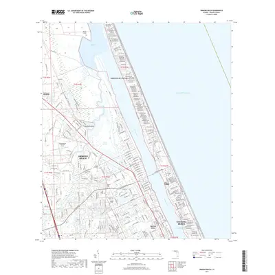
2018 Map of Ormond Beach
USGS Topo · Published 2018About this map
The Halifax River corridor and the Atlantic shoreline define this coastal landscape, showing the 2018 development patterns of Ormond Beach and its surrounding communities. The interior is characterized by the winding path of the Tomoka River, which flows through residential areas like Tomoka Estates before reaching the Tomoka Basin. This map is particularly useful for genealogical research, as it identifies several local burial grounds including Greenwood Cem, Hillside Cem, and the Volusia Memorial Park.
Find a feature on this map
309 named features on this map. Tap any name to fly to it.
Don’t see what you’re looking for? This feature index may not catch every label — zoom into the map to look around manually.
Map Details
Editions of this 2018 Ormond Beach Map
This is the sole edition of this map. No revisions or reprints were ever made.
Other maps of this area

1937 · Port Orange
USGS Topo · 1:48,000

1937 · Ormond
USGS Topo · 1:48,000

1943 · Port Orange
USGS Topo · 1:62,500

1944 · Ormond
USGS Topo · 1:62,500

1944 · Port Orange
USGS Topo · 1:62,500

1952 · Daytona Beach
USGS Topo · 1:24,000

1954 · Daytona Beach
USGS Topo · 1:250,000

1956 · Port Orange
USGS Topo · 1:24,000

1956 · Favoretta
USGS Topo · 1:24,000

1956 · Flagler Beach East
USGS Topo · 1:24,000
Featured Places
- Daytona Beach, FL
- Ormond Beach, FL
- Ellinor Village, Ormond Beach
- Ormond-by-the-Sea, FL
- Ortona, Daytona Beach