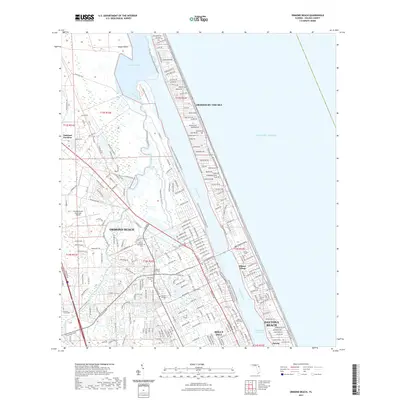
2021 Map of Ormond Beach
USGS Topo · Published 2021About this map
Tomoka State Park preserves the confluence of the Tomoka River and the Tomoka Basin, a distinct natural landscape that contrasts with the dense grid of the Volusia County coastline. The map reveals a complex interface between freshwater systems and the Halifax River lagoon, managed by modern recreational corridors like the Florida Circumnavigational Paddling Trail and the East Coast Greenway. For genealogists and local historians, the sheet is exceptionally detailed in its documentation of burial sites, including the Pilgrims Rest, Gethsemane, and French cemeteries. Urban growth is visible in the transition from the established streets of Ormond Beach and Holly Hill to the residential pockets of Ellinor Village and Ormond-by-the-Sea, all linked by the historic corridor of Old Dixie Hwy.
Find a feature on this map
46 named features on this map. Tap any name to fly to it.
Don’t see what you’re looking for? This feature index may not catch every label — zoom into the map to look around manually.
Map Details
Editions of this 2021 Ormond Beach Map
This is the sole edition of this map. No revisions or reprints were ever made.
Other maps of this area

1937 · Port Orange
USGS Topo · 1:48,000

1937 · Ormond
USGS Topo · 1:48,000

1943 · Port Orange
USGS Topo · 1:62,500

1944 · Ormond
USGS Topo · 1:62,500

1944 · Port Orange
USGS Topo · 1:62,500

1952 · Daytona Beach
USGS Topo · 1:24,000

1954 · Daytona Beach
USGS Topo · 1:250,000

1956 · Port Orange
USGS Topo · 1:24,000

1956 · Favoretta
USGS Topo · 1:24,000

1956 · Flagler Beach East
USGS Topo · 1:24,000
Featured Places
- Daytona Beach, FL
- Ormond Beach, FL
- Ellinor Village, Ormond Beach
- Ormond-by-the-Sea, FL
- Ortona, Daytona Beach