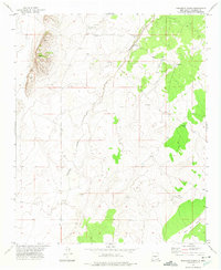
1972 Map of Orndorff Ranch
USGS Topo · Published 1975About this map
Orndorff Ranch and Fernandez Ranch anchor this arid New Mexico landscape, illustrating the essential relationship between high-desert ranching and available water sources. The terrain is defined by the winding Arroyo Chupadera and the drainage of Mesa Well Canyon in the southeast. Evidence of the region's ranching infrastructure is visible in the network of water features like Wilson Well, South Well, and Little Jug Tank, which were vital for sustaining livestock in this environment. The presence of a Landing Strip near the Orndorff property suggests the modern logistical needs of managing such large, isolated holdings in the early 1970s. While ranching dominates the surface, scattered labels for Prospect and other mineral explorations hint at the localized mining history common throughout Socorro County.
Find a feature on this map
11 named features on this map. Tap any name to fly to it.
Don’t see what you’re looking for? This feature index may not catch every label — zoom into the map to look around manually.
Map Details
Editions of this 1972 Orndorff Ranch Map
This is the sole edition of this map. No revisions or reprints were ever made.
Other maps of this area

1916 · La Joya
USGS Topo · 1:125,000

1918 · Oscura Peak
USGS Topo · 1:125,000

1948 · Carthage
USGS Topo · 1:62,500

1948 · Bingham
USGS Topo · 1:62,500

1954 · Tularosa
USGS Topo · 1:250,000

1954 · Socorro
USGS Topo · 1:250,000

1958 · Socorro
USGS Topo · 1:250,000

1958 · Tularosa
USGS Topo · 1:250,000

1962 · Socorro
USGS Topo · 1:250,000
1972 · Sierra Larga North
USGS Topo · 1:24,000