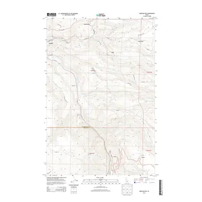
2013 Map of Orofino East
USGS Topo · Published 2013About this map
Clearwater River canyon walls define this part of northern Idaho, where the water flows south-to-north through a landscape marked by steep benches and narrow creek valleys. The settlement of Orofino occupies the northwest corner of the sheet, serving as a gateway to the highland timber and agricultural plateaus. Steep access routes like the Greer Grade Rd and Deer Creek Grade illustrate the challenging verticality required to move from the river level up to communities like Greer, Fraser, and Konkolville. The geography here is a complex network of named ridges and canyons, including Jim Ford Cr and Orofino Cr, which have historically dictated the placement of roads such as Grangemont Rd and Crockett Bench Rd. Local history is anchored at the Hill Cem above the river and the Greer Access Area, reflecting a region tied deeply to its river navigation and mountain topography.
Find a feature on this map
51 named features on this map. Tap any name to fly to it.
Don’t see what you’re looking for? This feature index may not catch every label — zoom into the map to look around manually.
Map Details
Editions of this 2013 Orofino East Map
This is the sole edition of this map. No revisions or reprints were ever made.
Other maps of this area

1924 · Kamiah
USGS Topo · 1:125,000

1955 · Pullman
USGS Topo · 1:250,000

1958 · Pullman
USGS Topo · 1:250,000

1961 · Ahsahka
USGS Topo · 1:62,500

1967 · Mohler
USGS Topo · 1:24,000

1967 · Sixmile Creek
USGS Topo · 1:24,000

1967 · Rudo
USGS Topo · 1:24,000

1967 · Orofino West
USGS Topo · 1:24,000
1967 · Woodland
USGS Topo · 1:24,000

1967 · Orofino East
USGS Topo · 1:24,000