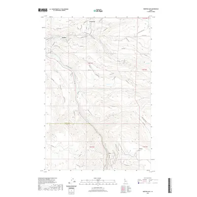
2020 Map of Orofino East
USGS Topo · Published 2020About this map
The Clearwater River serves as the primary geographic corridor through this section of Idaho, winding through a landscape shaped by significant elevation changes and deep creek drainages. Along its banks, the settlement of Orofino stands as a focal point, connected to outlying residential areas like Konkolville and the elevated plateaus of Crockett Bench. The mapping details the transition from the river valley to the high timber and agricultural lands, where smaller communities such as Greer and Fraser are established. Local history is anchored by landmarks like the Hill Cem and a dense network of mountain roads, including the Old Deer Creek Grade and Upper Fords Creek Rd, which reflect the region's logging and ranching heritage. Numerous tributaries like Orofino Cr and Jim Ford Cr carve through the terrain, illustrating the complex hydrology of Clearwater County.
Find a feature on this map
59 named features on this map. Tap any name to fly to it.
Don’t see what you’re looking for? This feature index may not catch every label — zoom into the map to look around manually.
Map Details
Editions of this 2020 Orofino East Map
This is the sole edition of this map. No revisions or reprints were ever made.
Other maps of this area

1924 · Kamiah
USGS Topo · 1:125,000

1955 · Pullman
USGS Topo · 1:250,000

1958 · Pullman
USGS Topo · 1:250,000

1961 · Ahsahka
USGS Topo · 1:62,500

1967 · Mohler
USGS Topo · 1:24,000

1967 · Sixmile Creek
USGS Topo · 1:24,000

1967 · Rudo
USGS Topo · 1:24,000

1967 · Orofino West
USGS Topo · 1:24,000
1967 · Woodland
USGS Topo · 1:24,000

1967 · Orofino East
USGS Topo · 1:24,000