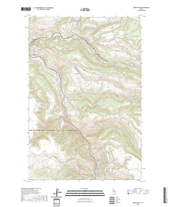
2024 Map of Orofino East
USGS Topo · Published 2024About this map
The Clearwater River winds through the deep valley of north-central Idaho, anchoring the western edge of this 2024 landscape. The settlement of Orofino marks the riverbank at the confluence with Orofino Creek, serving as a primary hub for the surrounding timberlands and plateaus. Moving east, the topography rises sharply toward Harmony Hts, revealing a network of local grades and ranch roads such as Gilbert Grade and Old Deer Creek Grade that follow the steep contours of the canyon walls.
Find a feature on this map
63 named features on this map. Tap any name to fly to it.
Don’t see what you’re looking for? This feature index may not catch every label — zoom into the map to look around manually.
Map Details
Editions of this 2024 Orofino East Map
This is the sole edition of this map. No revisions or reprints were ever made.
Other maps of this area

1924 · Kamiah
USGS Topo · 1:125,000

1955 · Pullman
USGS Topo · 1:250,000

1958 · Pullman
USGS Topo · 1:250,000

1961 · Ahsahka
USGS Topo · 1:62,500

1967 · Mohler
USGS Topo · 1:24,000

1967 · Sixmile Creek
USGS Topo · 1:24,000

1967 · Rudo
USGS Topo · 1:24,000

1967 · Orofino West
USGS Topo · 1:24,000
1967 · Woodland
USGS Topo · 1:24,000

1967 · Orofino East
USGS Topo · 1:24,000