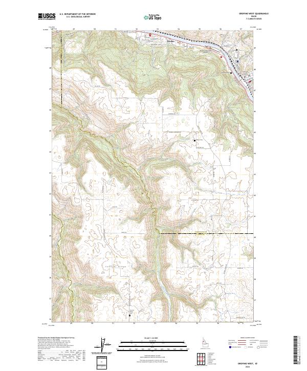
2024 Map of Orofino West
USGS Topo · Published 2024About this map
Orofino sits prominently along the Clearwater River at the northern edge of this modern survey, where the valley floor meets the rising elevations of the surrounding plateaus. The town’s role as a regional hub is evident through the inclusion of the Clearwater County Courthouse and the Orofino Municipal Airport. The landscape transitions from the river valley into the high agricultural and timber lands of Central Ridge, where long-established road networks like Ridgemont Dr and Gilbert Grade connect the river to the upland reaches. Genealogists will find several burial sites preserved across the terrain, including Riverside Cem near the riverbank and the isolated Gilbert Cem and Central Ridge Cem further south. The map documents a complex drainage system defined by Little Canyon Creek and Big Canyon Creek, illustrating the deep incisions these waterways have carved into the local topography.
Find a feature on this map
58 named features on this map. Tap any name to fly to it.
Don’t see what you’re looking for? This feature index may not catch every label — zoom into the map to look around manually.
Map Details
Editions of this 2024 Orofino West Map
This is the sole edition of this map. No revisions or reprints were ever made.
Other maps of this area

1924 · Kamiah
USGS Topo · 1:125,000

1955 · Pullman
USGS Topo · 1:250,000

1958 · Pullman
USGS Topo · 1:250,000

1961 · Ahsahka
USGS Topo · 1:62,500

1967 · Mohler
USGS Topo · 1:24,000

1967 · Fletcher
USGS Topo · 1:24,000

1967 · Sixmile Creek
USGS Topo · 1:24,000

1967 · Peck
USGS Topo · 1:24,000

1967 · Orofino West
USGS Topo · 1:24,000

1967 · Orofino East
USGS Topo · 1:24,000