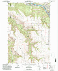
1994 Map of Orofino West
USGS Topo · Published 1997About this map
The Clearwater River serves as the focal point for this region, where the North Fork joins the main stem near the bustling settlement of Orofino. This 1994 revision, based on earlier aerial photography, illustrates a landscape defined by the steep descent from the Camas Prairie and Central Ridge toward the river valley. The infrastructure of the era is clearly visible, from the winding path of the Gilbert Grade to the Camas Prairie Railroad following the water's edge.
Find a feature on this map
28 named features on this map. Tap any name to fly to it.
Don’t see what you’re looking for? This feature index may not catch every label — zoom into the map to look around manually.
Map Details
Editions of this 1994 Orofino West Map
This is the sole edition of this map. No revisions or reprints were ever made.
Other maps of this area

1924 · Kamiah
USGS Topo · 1:125,000

1955 · Pullman
USGS Topo · 1:250,000

1958 · Pullman
USGS Topo · 1:250,000

1961 · Ahsahka
USGS Topo · 1:62,500

1967 · Mohler
USGS Topo · 1:24,000

1967 · Fletcher
USGS Topo · 1:24,000

1967 · Sixmile Creek
USGS Topo · 1:24,000

1967 · Peck
USGS Topo · 1:24,000

1967 · Orofino West
USGS Topo · 1:24,000

1967 · Orofino East
USGS Topo · 1:24,000