
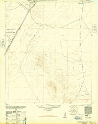
1947 Map of Orogrande North
USGS Topo · Published 1948About this map
The Jarilla Mountains dominate the western portion of this landscape, serving as a hub for mining operations including the Iron Queen Mine, Garnet Mine, Nannie Beard Mine, and Alice Mine. This 1947 survey captures the industrial and military intersection of the Tularosa Basin during the post-war era. Significant acreage is designated as the Fort Bliss Military Reservation, which overlaps with established ranching and mining infrastructure. The Southern Pacific railroad provides the primary transport corridor, passing through Orogrande and servicing specific stops such as Turquoise and its associated loading shutes. A small community core is visible at the Orogrande School and a nearby cemetery, while scattered landmarks like Benton Windmill and McNew Ranch indicate the sparse but essential water and ranching network necessary to survive this arid environment.
Find a feature on this map
25 named features on this map. Tap any name to fly to it.
Don’t see what you’re looking for? This feature index may not catch every label — zoom into the map to look around manually.
Map Details
Editions of this 1947 Orogrande North Map
This is the sole edition of this map. No revisions or reprints were ever made.
Other maps of this area

1916 · Point Of Sands
USGS Topo · 1:125,000

1940 · Orogrande
USGS Topo · 1:62,500

1943 · Pendejo Wash
USGS Topo · 1:62,500

1943 · Orogrande
USGS Topo · 1:62,500

1948 · El Wood
USGS Topo · 1:24,000
1948 · Orogrande South
USGS Topo · 1:24,000

1948 · Elephant Mountain
USGS Topo · 1:24,000

1948 · Tres Hermanos
USGS Topo · 1:62,500

1950 · Escondido Canyon
USGS Topo · 1:62,500

1954 · Carlsbad
USGS Topo · 1:250,000