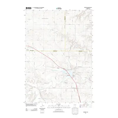
2013 Map of Oronoco
USGS Topo · Published 2013About this map
The Middle Fork Zumbro River and its various branches, including the South Br Middle Fork Zumbro River, dominate the drainage of this region where Goodhue, Olmsted, and Wabasha counties meet. The settlement of Oronoco is positioned along the shores of Shady Lake, where the Oronoco Bridge facilitates local transit. This 2013 survey reflects a landscape shaped by both water and agricultural division, with the rectilinear grid of county roads such as 100th St NW and 520th St NW cutting across the undulating terrain. To the northwest, the edge of Pine Island is visible, accompanied by the Pine Island Golf Course. Local heritage is anchored by significant sites like the Saint Peter's German Lutheran Cem and the Oronoco Cem, while the Wazionja Campground suggests the area's modern role in outdoor recreation.
Find a feature on this map
69 named features on this map. Tap any name to fly to it.
Don’t see what you’re looking for? This feature index may not catch every label — zoom into the map to look around manually.
Map Details
Editions of this 2013 Oronoco Map
This is the sole edition of this map. No revisions or reprints were ever made.
Other maps of this area

1935 · Rochester
USGS Topo · 1:48,000

1939 · Rochester
USGS Topo · 1:62,500

1951 · Lake City
USGS Topo · 1:62,500

1953 · Saint Paul
USGS Topo · 1:250,000

1959 · Saint Paul
USGS Topo · 1:250,000

1965 · Oronoco
USGS Topo · 1:24,000

1965 · Byron
USGS Topo · 1:24,000

1965 · Pine Island
USGS Topo · 1:24,000

1966 · Douglas
USGS Topo · 1:24,000

1968 · Zumbrota
USGS Topo · 1:24,000