Loading...
Loading map...2022 Map of Oronoco
USGS Topo · Published 2022About this map
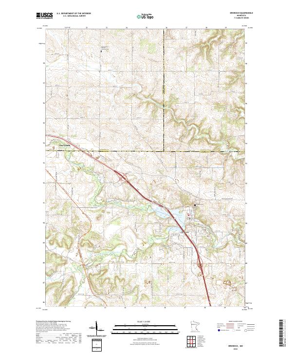
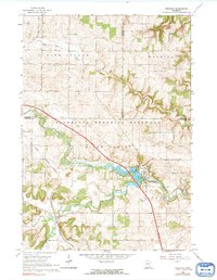
The Middle Fork Zumbro River anchors this corner of Southeast Minnesota, winding through the intersection of Goodhue, Olmsted, and Wabasha counties. The settlement of Oronoco sits at a sharp bend in the river, where the waters widen into Shady Lake. This modern topography shows the rural character of the area, defined by a grid of township roads like 500th St and Co Rd 12 that connect scattered farmsteads and agricultural plots.
Find a feature on this map
56 named features on this map. Tap any name to fly to it.
Don’t see what you’re looking for? This feature index may not catch every label — zoom into the map to look around manually.
Map Details
Date Portrayed2022
Date Published2022
PublisherU.S. Geological Survey
Map TypeTopographic
Scale1:24000
Physical Dimensions24 x 29 inches
Editions of this 2022 Oronoco Map
This is the sole edition of this map. No revisions or reprints were ever made.
Historical Maps of Pine Island Through Time
Featured Locations
Source Details
SourceU.S. Geological Survey
CopyrightPublic Domain