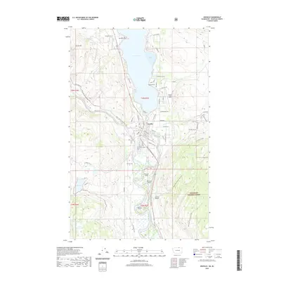
2020 Map of Oroville
USGS Topo · Published 2020About this map
Oroville serves as the focal point of this region where the Similkameen River meets the Okanogan River just south of the international border. The landscape is defined by significant water bodies, including the expansive Osoyoos Lake and smaller features like Johnny Johnson Lake and Mud Lake. Historical and navigational points are prominent, ranging from the Riverview Cem to the Dorothy Scott Airport, reflecting the community's infrastructure alongside the vast Okanogan National Forest.
Find a feature on this map
81 named features on this map. Tap any name to fly to it.
Don’t see what you’re looking for? This feature index may not catch every label — zoom into the map to look around manually.
Map Details
Editions of this 2020 Oroville Map
This is the sole edition of this map. No revisions or reprints were ever made.
Other maps of this area

1902 · Osoyoos
USGS Topo · 1:125,000

1904 · Osoyoos
USGS Topo · 1:125,000

1906 · Chopaka
USGS Topo · 1:125,000

1954 · Okanogan
USGS Topo · 1:250,000

1956 · Loomis
USGS Topo · 1:62,500

1957 · Oroville
USGS Topo · 1:62,500

1958 · Okanogan
USGS Topo · 1:250,000

1975 · Oroville NW
USGS Topo · 1:24,000
1981 · Burge Mtn
USGS Topo · 1:24,000

1981 · Mount Hull
USGS Topo · 1:24,000