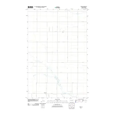
2011 Map of Orr
USGS Topo · Published 2011About this map
McCanna and Orr anchor this rural landscape in Grand Forks County, representing the small-town settlement patterns of eastern North Dakota. The terrain is defined by the winding course of the North Branch Turtle River, which meanders across the prairie, joined by the curiously named Whisky Creek. This area maintains a strict section-line road grid, with routes like 31st Ave NE and 42nd St NE carving the land into the precise rectangles characteristic of the Great Plains' agricultural development. The proximity of the river and creek to these established settlements suggests the historic importance of reliable water sources and drainage in an otherwise expansive and open environment. This survey captures the region as it appeared in the early 21st century, showing the enduring footprint of these communities and their relationship to the local hydrology.
Find a feature on this map
25 named features on this map. Tap any name to fly to it.
Don’t see what you’re looking for? This feature index may not catch every label — zoom into the map to look around manually.
Map Details
Editions of this 2011 Orr Map
This is the sole edition of this map. No revisions or reprints were ever made.
Other maps of this area

1936 · Larimore
USGS Topo · 1:62,500

1939 · Niagara
USGS Topo · 1:62,500

1952 · Grand Forks
USGS Topo · 1:250,000

1952 · Thief River Falls
USGS Topo · 1:250,000

1956 · Thief River Falls
USGS Topo · 1:250,000

1956 · Grand Forks
USGS Topo · 1:250,000

1957 · Thief River Falls
USGS Topo · 1:250,000

1963 · Orr
USGS Topo · 1:24,000

1963 · Larimore East
USGS Topo · 1:24,000

1963 · Inkster NE
USGS Topo · 1:24,000