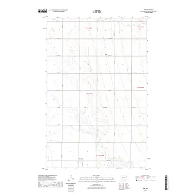
2020 Map of Orr
USGS Topo · Published 2020About this map
Orr and McCanna sit within the agricultural landscape of Grand Forks County, where the topography is defined by the winding paths of the N Br Turtle River and its tributaries. This 2020 survey reveals a highly organized grid of rural roads, including Co Rd 14 and McCanna St W, which facilitate movement between the scattered farmsteads and small communities. The presence of Whisky Cr and the North Branch Turtle River highlights the drainage patterns essential to the region's farming heritage. The map documents the persistent township and range divisions, such as t154n r55w, that have anchored North Dakota land ownership for generations. The modest footprints of the named settlements indicate a quiet, rural character maintained into the early 21st century.
Find a feature on this map
22 named features on this map. Tap any name to fly to it.
Don’t see what you’re looking for? This feature index may not catch every label — zoom into the map to look around manually.
Map Details
Editions of this 2020 Orr Map
This is the sole edition of this map. No revisions or reprints were ever made.
Other maps of this area

1936 · Larimore
USGS Topo · 1:62,500

1939 · Niagara
USGS Topo · 1:62,500

1952 · Grand Forks
USGS Topo · 1:250,000

1952 · Thief River Falls
USGS Topo · 1:250,000

1956 · Thief River Falls
USGS Topo · 1:250,000

1956 · Grand Forks
USGS Topo · 1:250,000

1957 · Thief River Falls
USGS Topo · 1:250,000

1963 · Orr
USGS Topo · 1:24,000

1963 · Larimore East
USGS Topo · 1:24,000

1963 · Inkster NE
USGS Topo · 1:24,000