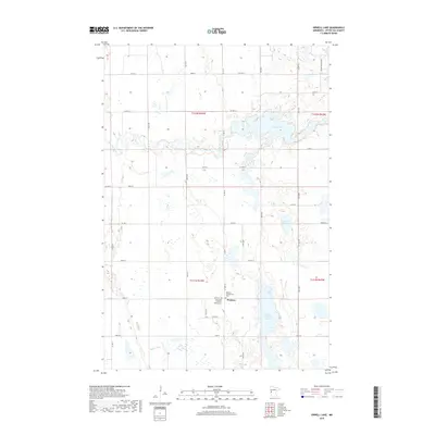
2019 Map of Orwell Lake
USGS Topo · Published 2019About this map
The Western township area of Otter Tail County is defined by its low-lying prairie potholes and the significant waters of Orwell Lake. This 2019 survey captures the rural community structure at the intersection of local routes like CO Hwy 2 and CO Hwy 114. The landscape is a complex network of wetlands and drainage basins, where the Otter Tail River and Rabbit River meander through the glacial till. Local genealogy and settlement history are anchored by the Western Presbyterian Ch and the Emmanuel Lutheran Church, with the adjacent Emmanuel Lutheran Cem serving as a primary local landmark. The presence of Upper Lightning Lake and Faunce Lake further illustrates the water-rich geography of the region, which has long influenced the placement of farms and cemeteries across this part of Minnesota.
Find a feature on this map
28 named features on this map. Tap any name to fly to it.
Don’t see what you’re looking for? This feature index may not catch every label — zoom into the map to look around manually.
Map Details
Editions of this 2019 Orwell Lake Map
This is the sole edition of this map. No revisions or reprints were ever made.
Other maps of this area

1910 · Wendell
USGS Topo · 1:62,500

1913 · Fergus Falls
USGS Topo · 1:62,500

1913 · Wendell
USGS Topo · 1:62,500

1919 · Rothsay
USGS Topo · 1:62,500

1951 · Rothsay
USGS Topo · 1:62,500

1951 · Campbell
USGS Topo · 1:62,500

1953 · Fargo
USGS Topo · 1:250,000

1956 · Fargo
USGS Topo · 1:250,000

1966 · Carlisle
USGS Topo · 1:24,000
1973 · Dayton Hollow Dam
USGS Topo · 1:24,000