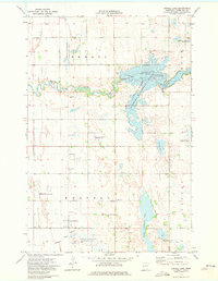
1973 Map of Orwell Lake
USGS Topo · Published 1975About this map
The Otter Tail River dominates this mid-1970s landscape, winding through a complex of managed wetlands and reservoirs in Otter Tail County. The hydrology of the region is defined by the Orwell Lake reservoir system and the Orwell Dam, which regulates water flow through the Orwell State Wildlife Management Area. This era shows a clear emphasis on conservation and habitat management, with numerous National Waterfowl Production Areas and the Doran State Wildlife Management Area preserved across the townships of Orwell and Western. Local civic life is anchored by the Western Townhall, while the southern reaches of the quadrangle feature Upper Lightning Lake and the meandering Rabbit River. The map also documents industrial land use through scattered Gravel Pits, often situated near the river valleys where glacial deposits were most accessible.
Find a feature on this map
21 named features on this map. Tap any name to fly to it.
Don’t see what you’re looking for? This feature index may not catch every label — zoom into the map to look around manually.
Map Details
Editions of this 1973 Orwell Lake Map
This is the sole edition of this map. No revisions or reprints were ever made.
Other maps of this area

1910 · Wendell
USGS Topo · 1:62,500

1913 · Fergus Falls
USGS Topo · 1:62,500

1913 · Wendell
USGS Topo · 1:62,500

1919 · Rothsay
USGS Topo · 1:62,500

1951 · Rothsay
USGS Topo · 1:62,500

1951 · Campbell
USGS Topo · 1:62,500

1953 · Fargo
USGS Topo · 1:250,000

1956 · Fargo
USGS Topo · 1:250,000

1966 · Carlisle
USGS Topo · 1:24,000
1973 · Dayton Hollow Dam
USGS Topo · 1:24,000