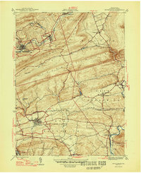
1947 Map of Orwigsburg
USGS Topo · Published 1947About this map
Orwigsburg serves as a central hub in this mid-century survey of Schuylkill County, where the landscape is defined by the heavy presence of the Reading railroad and the winding paths of the Schuylkill River and Little Schuylkill River. The map captures a transitional geography where industrial settlements like New Philadelphia Silver Creek P O, Middleport, and Kaska are situated along the northern ridges of Sharp Mountain and Second Mountain.
Find a feature on this map
39 named features on this map. Tap any name to fly to it.
Don’t see what you’re looking for? This feature index may not catch every label — zoom into the map to look around manually.
Map Details
Editions of this 1947 Orwigsburg Map
2 editions found
Other maps of this area

1889 · Hazleton
USGS Topo · 1:62,500

1889 · Pottsville
USGS Topo · 1:62,500

1891 · Hazleton
USGS Topo · 1:62,500

1891 · Pottsville
USGS Topo · 1:62,500

1892 · Mahanoy
USGS Topo · 1:62,500

1893 · Hazleton
USGS Topo · 1:62,500

1893 · Mahanoy
USGS Topo · 1:62,500

1909 · Hamburg
USGS Topo · 1:62,500

1911 · Hamburg
USGS Topo · 1:62,500

1944 · Pottsville
USGS Topo · 1:24,000
Featured Places
- Orwigsburg, PA
- New Philadelphia, PA
- Deer Lake, West Brunswick Township
- Middleport, PA
- North Manheim Township, PA