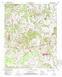
1950 Map of Osage
USGS Topo · Published 1985About this map
Cottage Grove and New Boston anchor this rural landscape in Henry County, where small agricultural settlements and country churches define the community structure of the mid-20th century. The terrain is shaped by the Middle Fork Obion River and the Obion River Canal, which cut through the southern portion of the quadrangle. Significant family and community history is preserved through a high density of small burial grounds, such as Cedar Hill Cem, Lampkins Cem, and Looney Cem, scattered across the undulating countryside. The presence of the Henry County Airport in the east marks a point of modern infrastructure amidst more traditional landmarks like Oak Hill Church and Gum Spring Church. To the west, Ward Bottom and the winding course of Walnut Fork Creek illustrate the natural drainage patterns that have long influenced local land use and road placement.
Find a feature on this map
46 named features on this map. Tap any name to fly to it.
Don’t see what you’re looking for? This feature index may not catch every label — zoom into the map to look around manually.
Map Details
Editions of this 1950 Osage Map
3 editions found
Other maps of this area

1936 · Conyersville
USGS Topo · 1:24,000

1936 · Crossland
USGS Topo · 1:24,000

1936 · Mansfield
USGS Topo · 1:24,000

1936 · Paris
USGS Topo · 1:24,000

1950 · Osage
USGS Topo · 1:24,000

1950 · Paris
USGS Topo · 1:24,000

1950 · Mansfield
USGS Topo · 1:24,000

1950 · Puryear
USGS Topo · 1:24,000

1950 · Cottage Grove
USGS Topo · 1:24,000

1955 · Henry
USGS Topo · 1:24,000