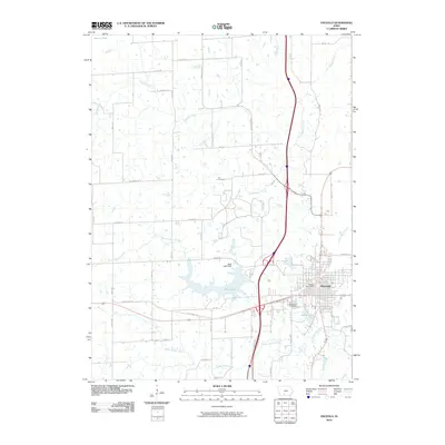
2010 Map of Osceola
USGS Topo · Published 2010About this map
Osceola serves as the central hub for this portion of Clarke County, with its grid-like street pattern expanding toward the recreational and municipal waters of West Lake and Grade Lake. The landscape is defined by the headwaters and branches of several significant drainage systems, including White Breast Creek and South Squaw Creek, which weave between a dense network of county roads like Truro Pavement and Lacelle RD. Genealogy researchers can locate burial sites at Maple Hill Cemetery on the edge of town and Cox Cemetery further north, while the Osceola Post Office marks the civic heart of the community. The presence of West Lake Dam and various unnamed ponds across the southern terrain illustrates a managed water system designed for both utility and flood control in this agricultural and residential region.
Find a feature on this map
42 named features on this map. Tap any name to fly to it.
Don’t see what you’re looking for? This feature index may not catch every label — zoom into the map to look around manually.
Map Details
Editions of this 2010 Osceola Map
This is the sole edition of this map. No revisions or reprints were ever made.
Other maps of this area

1950 · New Virginia
USGS Topo · 1:62,500

1951 · Osceola
USGS Topo · 1:62,500

1952 · New Virginia
USGS Topo · 1:62,500

1954 · Centerville
USGS Topo · 1:250,000

1954 · Des Moines
USGS Topo · 1:250,000

1956 · Des Moines
USGS Topo · 1:250,000

1957 · Des Moines
USGS Topo · 1:250,000

1957 · Centerville
USGS Topo · 1:250,000

1958 · Centerville
USGS Topo · 1:250,000

1965 · Weldon
USGS Topo · 1:24,000