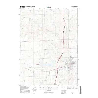
2015 Map of Osceola
USGS Topo · Published 2015About this map
Osceola serves as the focal point of this Southern Iowa landscape, showing a dense grid of residential streets and civic landmarks during the mid-2010s. The town's historical geography is anchored by Maple Hill Cem on the west side, while the surrounding countryside is defined by the headwaters of White Breast Cr and its tributaries. To the west of the city center, West Lake provides a significant water feature, complemented by smaller bodies like Grade Lake and the uniquely named Q-Pond.
Find a feature on this map
46 named features on this map. Tap any name to fly to it.
Don’t see what you’re looking for? This feature index may not catch every label — zoom into the map to look around manually.
Map Details
Editions of this 2015 Osceola Map
This is the sole edition of this map. No revisions or reprints were ever made.
Other maps of this area

1950 · New Virginia
USGS Topo · 1:62,500

1951 · Osceola
USGS Topo · 1:62,500

1952 · New Virginia
USGS Topo · 1:62,500

1954 · Centerville
USGS Topo · 1:250,000

1954 · Des Moines
USGS Topo · 1:250,000

1956 · Des Moines
USGS Topo · 1:250,000

1957 · Des Moines
USGS Topo · 1:250,000

1957 · Centerville
USGS Topo · 1:250,000

1958 · Centerville
USGS Topo · 1:250,000

1965 · Weldon
USGS Topo · 1:24,000