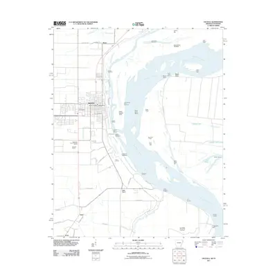
2011 Map of Osceola
USGS Topo · Published 2011About this map
The Mississippi River dominates this portion of Mississippi County, defining the shifting boundary between Arkansas and Tennessee through a complex system of dikes and revetments. The city of Osceola serves as the primary hub, where the Osceola Port Terminal and Osceola Landing underscore the continued importance of river-based commerce. The landscape is heavily managed for flood control, evidenced by the prominent Levee Rd and protective structures like the Island Number Thirty Revetment and Plum Point Dikes.
Find a feature on this map
66 named features on this map. Tap any name to fly to it.
Don’t see what you’re looking for? This feature index may not catch every label — zoom into the map to look around manually.
Map Details
Editions of this 2011 Osceola Map
This is the sole edition of this map. No revisions or reprints were ever made.
Other maps of this area

1939 · Blytheville
USGS Topo · 1:62,500

1939 · Evadale
USGS Topo · 1:62,500

1941 · Manila
USGS Topo · 1:62,500

1953 · Memphis
USGS Topo · 1:250,000

1955 · Blytheville
USGS Topo · 1:62,500

1956 · Manila
USGS Topo · 1:62,500

1956 · Evadale
USGS Topo · 1:62,500

1956 · Memphis
USGS Topo · 1:250,000

1956 · Blytheville
USGS Topo · 1:250,000

1959 · Blytheville
USGS Topo · 1:250,000