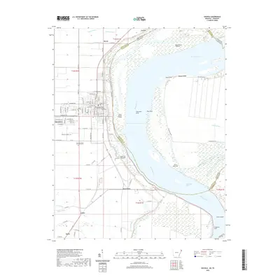
2020 Map of Osceola
USGS Topo · Published 2020About this map
The Mississippi River dominates this eastern Mississippi County landscape, carving a complex path along the Arkansas Tennessee border. The river's dynamic nature is evident through numerous features like Plum Point Bend, Island Number Thirty, and Kate Aubrey Towhead. On the western bank, the city of Osceola serves as a focal point, anchored by the Mississippi County - Osceola Courthouse. The surrounding area is a network of drainage systems and agricultural lands, with Lynch Bayou and Catalpa Bayou feeding into the delta's complex hydrology.
Find a feature on this map
74 named features on this map. Tap any name to fly to it.
Don’t see what you’re looking for? This feature index may not catch every label — zoom into the map to look around manually.
Map Details
Editions of this 2020 Osceola Map
This is the sole edition of this map. No revisions or reprints were ever made.
Other maps of this area

1939 · Blytheville
USGS Topo · 1:62,500

1939 · Evadale
USGS Topo · 1:62,500

1941 · Manila
USGS Topo · 1:62,500

1953 · Memphis
USGS Topo · 1:250,000

1955 · Blytheville
USGS Topo · 1:62,500

1956 · Manila
USGS Topo · 1:62,500

1956 · Evadale
USGS Topo · 1:62,500

1956 · Memphis
USGS Topo · 1:250,000

1956 · Blytheville
USGS Topo · 1:250,000

1959 · Blytheville
USGS Topo · 1:250,000