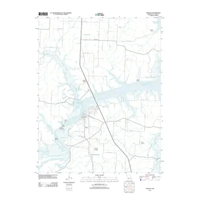
2011 Map of Osceola
USGS Topo · Published 2011About this map
Osceola serves as the focal point of this landscape, situated where the Osage River and Sac River meet amidst the sprawling waters of the Harry S Truman Reservoir. This 2011 survey illustrates the modern topography of St. Clair County, defined by the intricate shoreline of the reservoir which has submerged much of the low-lying river valley. Notable terrain features like Rock of Ages Bluff and Lilleys Island rise above the water, while the rural surrounding areas maintain a network of county roads connecting small settlements like Damascus. Local history and genealogy are well-represented by several burial sites, including Osceola Cemetery, Pleasant Mound Cemetery, and Wisner Number 2 Cemetery. The transition from river-bottom lands to upland plateaus is marked by various creeks such as Gallinipper Creek and Monegaw Creek, while the Osceola Municipal Airport indicates the modern infrastructure serving this river-bend community.
Find a feature on this map
70 named features on this map. Tap any name to fly to it.
Don’t see what you’re looking for? This feature index may not catch every label — zoom into the map to look around manually.
Map Details
Editions of this 2011 Osceola Map
This is the sole edition of this map. No revisions or reprints were ever made.
Other maps of this area

1886 · Stockton
USGS Topo · 1:125,000

1887 · Clinton
USGS Topo · 1:125,000

1894 · Clinton
USGS Topo · 1:125,000

1938 · Monegaw Springs
USGS Topo · 1:24,000

1938 · Roscoe
USGS Topo · 1:24,000

1938 · Vista
USGS Topo · 1:24,000

1939 · Osceola
USGS Topo · 1:24,000

1940 · Roscoe
USGS Topo · 1:24,000

1940 · Osceola
USGS Topo · 1:24,000

1940 · Vista
USGS Topo · 1:24,000